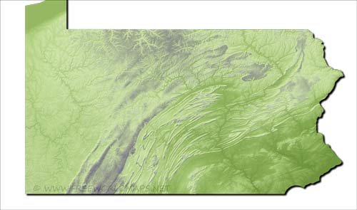
Physical map of Pennsylvania
Physical map of Pennsylvania, equirectangular projection
Click on above map to view higher resolution image
Physical features of Pennsylvania
Location: Mid-Atlantic and Northeastern regions of the United States
Capital: Harrisburg
Largest city: Philadelphia
Important cities: Pittsburgh, Erie, Williamsport, Wilkes-Barre, Allentown
Nieghbouring states: New Jersey, New York, Maryland, Ohio, West Virginia
Geographic Features: Allegheny Plateau, Appalachian Mountains, Pennsylvania Dutch Country
Major rivers: Ohio, Allegheny, Delaware, Susquehanna, Monongahela
Largest Lake: Lake Erie
Highest Point: Mount Davis (979 m)
Other maps of Pennsylvania
Check our other maps of the state of Pennsylvania
Customized Pennsylvania maps
Could not find what you're looking for? Need a customized Pennsylvania map? We can create the map for you!Crop a region, add/remove features, change shape, different projections, adjust colors, even add your locations!


