Sometimes it’s not at all easy to define what you’re expecting from a map. We at freeworldmaps.net are helping our visitors to create exactly what they need, either for business, private or educational needs. Our specialties include world maps, continent maps, country maps, region maps. All of them in different styles, should you need a physical, political, or thematic map.
Custom Mapping Services
Affordable prices starting at $50
Maps delivered as bitmap or vector (ai, pdf or svg) files.
Use the map on your website, publication or presentation
Royalty free license
Express delivery: maps available in 1-3 days
We can deliver several types of maps:
World maps, in many different styles
Country maps, region maps
Physical maps, political maps, general maps, or special thematic maps
Some samples of our customized maps
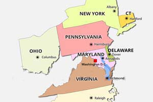
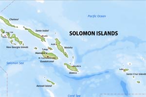
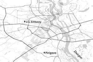
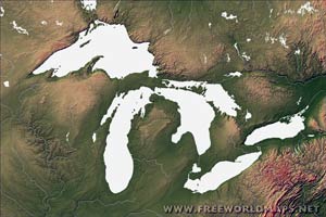
Bilingual China mapColor coded world mapCustomized Europe mapMap of the Midatlantic regionDetailed map of the SouthEast USNorth-East customized mapSolomon Islands mapGraphic map of KievGreat Lakes region
Get any world map, map of any of the continents, or any country designed specifically for you, your website or your presentation.
Custom Map Design Services
Need a custom map designed specifically for your project? FreeWorldMaps provides custom map design and cartography services for businesses, publishers, educators, organizations, websites, presentations, and private projects.
Whether you need a custom world map, country map, continent map, regional map, political map, physical map, or thematic map, we can create a map based on your requirements, preferred style, geographic area, colors, labels, and level of detail.
Custom Maps Designed for Your Needs
Every project has different mapping requirements. Instead of adapting an existing map to fit your needs, a custom map can be designed specifically for your website, publication, presentation, educational material, or business application.
Custom maps can be created for:
World maps
Continent maps
Country maps
Regional maps
City and local area maps
Political maps
Physical maps
General reference maps
Thematic maps
Color-coded maps
Custom geographic illustrations
You can specify the geographic area, map style, colors, labels, borders, geographic features, and other details needed for your project.
Custom World Maps and Country Maps
A custom world map can be created to highlight specific countries, regions, markets, territories, routes, or geographic information. Individual countries and regions can be emphasized with different colors or graphical treatments.
We can also create custom country maps and regional maps when you need more geographic detail than a standard world map provides.
Custom maps are suitable for projects such as:
International business presentations
Global sales and market maps
Educational materials
Travel and tourism publications
Books and magazines
Websites and online publications
Corporate reports
Infographics
Research and data visualization
Marketing materials
Political, Physical and Thematic Maps
Different projects require different types of geographic information. We can create several styles of custom maps depending on the purpose of your project.
Political maps can emphasize countries, states, provinces, regions, administrative boundaries, and political divisions.
Physical maps can highlight geographic features such as mountains, rivers, lakes, coastlines, and other natural features.
Thematic maps can be designed around a specific subject or dataset, allowing geographic areas to be highlighted according to your requirements.
A color-coded world map or regional map can also be created to visually distinguish countries, territories, markets, categories, or other geographic information.
Custom Maps in Vector and Bitmap Formats
Your finished map can be delivered in formats suitable for both digital and print applications.
Available formats include:
AI – Adobe Illustrator vector format
SVG – scalable vector graphics
PDF – suitable for printing and document publishing
Bitmap/raster images – suitable for websites, presentations, and digital applications
Vector formats are particularly useful when you need to resize a map, modify individual geographic elements, change colors, or prepare the map for professional printing.
Custom Maps for Websites, Publications and Presentations
A professionally designed custom map can make geographic information much easier to understand.
Use your custom map on:
Business websites
News and media websites
Company presentations
PowerPoint presentations
Books and magazines
Reports and annual reports
Brochures and marketing materials
Educational websites
Classroom resources
Research publications
Digital infographics
The maps are supplied with a royalty-free license, allowing you to use the finished map for your intended project.
Affordable Custom Cartography
Custom map projects start at $50, making professional custom cartography accessible for a wide range of projects. The final price depends on the geographic area, level of detail, map style, and customization required.
For projects that require a quick turnaround, express delivery is available, with maps typically delivered within 1–3 days.
Examples of Custom Maps
Custom mapping projects can range from a bilingual country map and color-coded world map to detailed regional maps and specially designed geographic illustrations.
Examples include:
Bilingual maps
Color-coded world maps
Customized Europe maps
Regional maps of the United States
Detailed country maps
Island and territory maps
Custom city maps
Special-purpose geographic illustrations
These examples demonstrate how a standard geographic map can be adapted to suit a particular visual style or project requirement.
Why Choose a Custom Map?
A custom map gives you control over the geographic information and visual presentation instead of forcing your project to fit a generic map.
With a custom map, you can:
Select the geographic area
Choose the map style
Highlight specific countries or regions
Customize colors
Add or remove labels
Emphasize borders and geographic features
Create a map for a specific publication or presentation
Receive the final map in a professional vector format
Request a Custom Map
Tell us what geographic area you need, what information the map should show, and how you plan to use it. We can create a custom map designed specifically for your website, business, publication, presentation, educational project, or other application.
Whether you need a custom world map, country map, regional map, political map, physical map, thematic map, or color-coded map, our custom mapping service can provide a map tailored to your requirements.