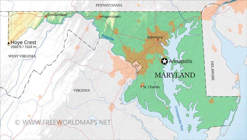
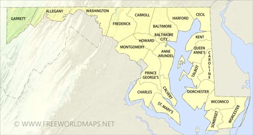
Physical map of Maryland
Physical map of Maryland, equirectangular projection
Click on above map to view higher resolution image
Physical features of Maryland
Location: East Coast of the United States
Capital: Annapolis
Largest city: Baltimore
Other important cities: Hancock, Frederick, Gaithersburg
Nieghbouring states: Delaware, Pennsylvania, West Virginia, Virginia, Washingon D.C.
Geographic Features: Backbone Mountain, Delmarva Peninsula, Potomac River, Chesapeake Bay
Highest Point: Hoye Crest on Backbone Mountain
Other maps of Maryland
Check our other maps of the state of Maryland
Customized Maryland maps
Could not find what you're looking for? Need a customized Maryland map? We can create the map for you!Crop a region, add/remove features, change shape, different projections, adjust colors, even add your locations!


