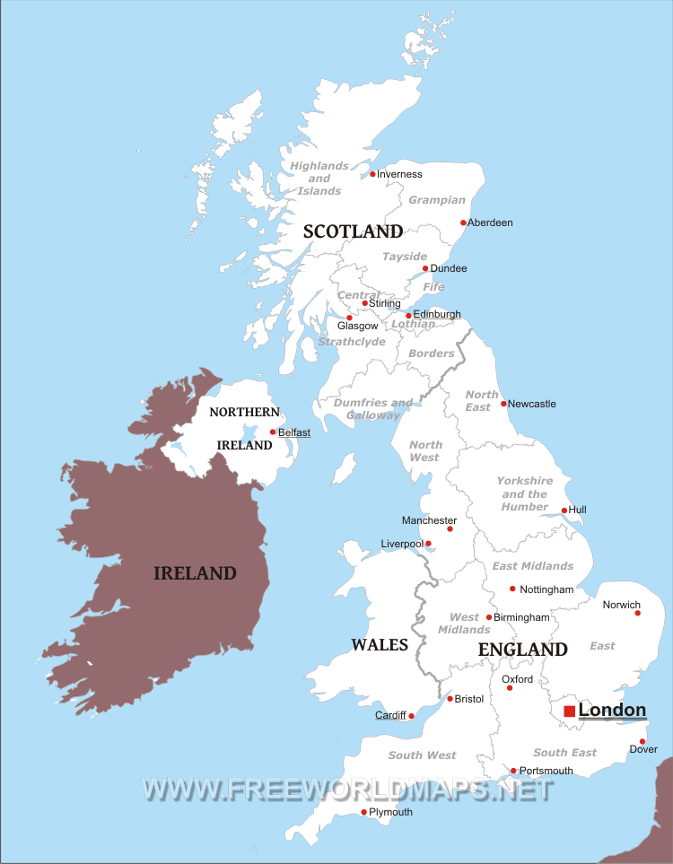
The United Kingdom of Great Britain and Northern Ireland includes the separate countries of
England,
Scotland,
Wales and
Northern Ireland.
England is divided into 9 regions:
South West, South East, East of England, West Midlands, East Midlands, Yorkshire and the Humber, North East, North West and Greater London.
These regions of England are further divided into the following ceremonial counties:
East Midlands: Derbyshire, Nottinghamshire, Lincolnshire, Leicestershire, Rutland and Northamptonshire
East of England: Essex, Hertfordshire, Bedfordshire, Cambridgeshire, Norfolk and Suffolk
North East: Northumberland, Tyne and Wear, Durham, North Yorkshire
North West: Cheshire, Cumbria, Greater Manchester, Lancashire, Merseyside
South East: Berkshire, Buckinghamshire, East Sussex, Hampshire, Isle of Wight, Kent, Oxfordshire, Surrey, West Sussex
South West: Somerset, Bristol, Gloucestershire, Wiltshire, Dorset, Devon, Cornwall
West Midlands: Herefordshire, Shropshire, Staffordshire, Warwickshire, Worcestershire
Yorkshire and the Humber: West Yorkshire, South Yorkshire, East Riding of Yorkshire, North Yorkshire, Lincolnshire
Largest cities of England, as refernce to the above map are:
London, Manchester, Liverpool, Newcastle, Birmingham, Nottingham, Hull, Norwich, Oxford, Plymouth, Portsmouth, Bristol, Dover
Scotland is divided into nine regions as well:
Highlands and Islands, Grampian, Tayside, Central Scotland, Fife, Lothian, Strathclyde, The Borders, Dumfries and Galloway.
There are 6 cities in Scotland: Edinburgh, Glasgow, Aberdeen, Dundee, Inverness, Stirling.
United Kingdom Political Map

Political map of United Kingdom, equirectangular projection
Other maps of United Kingdom
Customized United Kingdom maps
Could not find what you're looking for? Need a special United Kingdom map? We can create the map for you!Crop a region, add/remove features, change shape, different projections, adjust colors, even add your locations!


