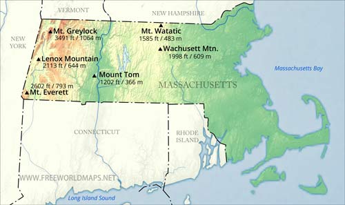
Physical map of Massachusetts
Physical map of Massachusetts, equirectangular projection
Click on above map to view higher resolution image
Physical features of Massachusetts
Location: Northeastern region of the United States, Atlantic Coast
Capital: Boston
Largest city: Boston
Other important cities: Springfield, Lowell, Cambridge, Worcester
Nieghbouring states: Rhode Island, New York, Connecticut, Vermont, New Hampshire
Geographic Features: The Berkshires, Pioneer Valley, Cape Cod, Martha's Vineyard, Nantucket
Major rivers: Connecticut
Largest Lake: Quabbin Reservoir
Highest Point: Mount Greylock (1064 m)
Other maps of Massachusetts
Check our other maps of the state of Massachusetts
Customized Massachusetts maps
Could not find what you're looking for? Need a customized Massachusetts map? We can create the map for you!Crop a region, add/remove features, change shape, different projections, adjust colors, even add your locations!


