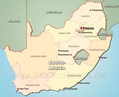
South Africa is situated on the southern tip of Africa.
Two-thirds of the terrain is plateau, called Highveld. The Great Escarpment runs along the east, south and west of the Highveld. There is a thin coastal strip, the Lowveld. The Orange river runs from the east to the west of the country.
Giant's Castle is the country's highest point at 3314 meters above sea level.
The main rivers of South Africa are the Orange emptying into the Atlantic Ocean at the Namibian border and the Limpopo.
Pretoria (Tshwane) is South Africa's administrative capital with its legislative and judicial centres in Cape Town and Bloemfontein respectively.
South Africa Physical Map
Physical map of South Africa, equirectangular projection
Click on above map to view higher resolution image
South Africa physical features
Other maps of South Africa
Customized South Africa maps
Could not find what you're looking for? Need a customized South Africa map? We can create the map for you!Crop a region, add/remove features, change shape, different projections, adjust colors, even add your locations!


