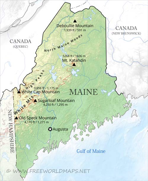
Maine is a state in the New England region of the northeastern United States,
between Canada and the Atlantic Ocean.
Maine also has the distinction of being the only state to border just one other state: New Hampshire to the west.
Moosehead Lake is the largest lake in New England. Mount Katahdin is the highest peak, rising in the Appalachian Mountains to 1605 meters.
The major rivers in Maine are the Saint John River, Kennebec River, Androscoggin River, the St. Croix River and the Penobscot River.
The capital is Augusta, largest city is Portland. Other major cities in Maine include Lewiston, Bangor, Eastport and Presque Isle.
Physical map of Maine
Physical map of Maine, equirectangular projection
Click on above map to view higher resolution image
Physical features of Maine
Other maps of Maine
Check our other maps of the state of Maine
Customized Maine maps
Could not find what you're looking for? Need a customized Maine map? We can create the map for you!Crop a region, add/remove features, change shape, different projections, adjust colors, even add your locations!


