Physical map of Saskatchewan, physical features of Saskatchewan
Click on above map to view higher resolution image
Information about the physical features of Saskatchewan
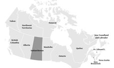
Saskatchewan is one of the ten provinces of Canada, lying in the southern section of the country, between Alberta and Manitoba.
The northern part of the province is occupied by the Canadian shield, while the southern area is part of the Interior Plains.
The highes point of Saskatchewan can be found in the Cypress Hills lying in the southwestern part of the province.
Saskatchewan's capital is Regina, while the most populous city is Saskatoon.
List of the geographical names of Saskatchewan as shown on the map
Main cities:
Lloydminster, Moose Jaw, Prince Albert, Regina, Saskatoon, Yorkton, Swift Current, North Battleford, Estevan, Weyburn, Flin Flon
Major rivers of Saskatchewan:
Saskatchewan, Assiniboine, South Saskatchewan, Beaver
Major lakes of Saskatchewan:
Lake Athabasca, Reindeer Lake, Wollaston Lake, Lake Ronge, Cree Lake
Mountains, regions:
Cypress Hills
Saskatchewan relief
Topography of Saskatchewan, shaded relief physical map of Saskatchewan
Other maps of Saskatchewan
Check our other maps of the state of Saskatchewan
Location map of Saskatchewan
Customized Saskatchewan maps
Could not find what you're looking for? Need a customized Saskatchewan map? We can create the map for you! Crop a region, add/remove features, change shape, different projections, adjust colors, even add your locations!