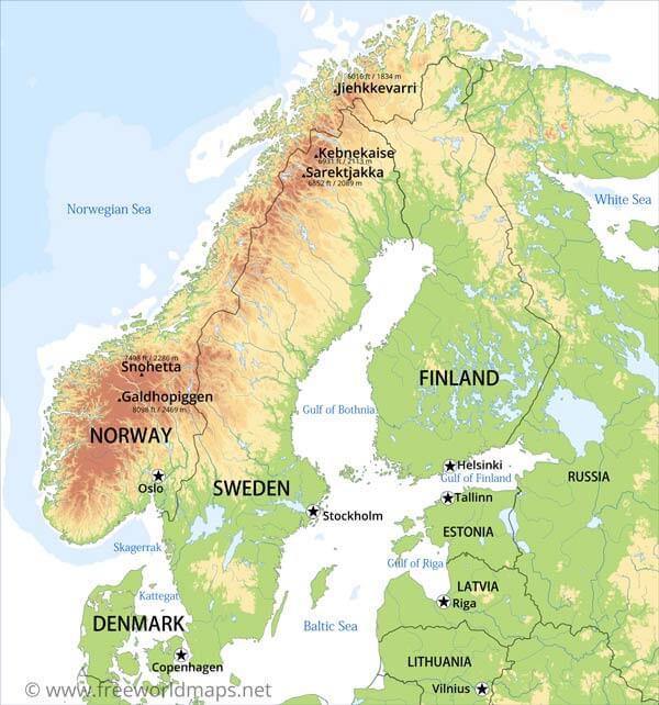
Location: Northern Europe
Capitals: Stockholm, Oslo, Helsinki, Copenhagen
Countries:
Finland,
Norway,
Sweden,
Iceland,
Denmark
Regions: Lappland, Scandinavian Mountains
Lakes: Vänern, Vättern
Seas: Baltic Sea, North Sea, Gulf of Bothnia, Gulf of Finland, Norwegian Sea
Highest Points: Galdhøpiggen (2469 m), Kebnekaise (2111 m)
Scandinavia Physical Map

Physical Map of Scandinavia (including Iceland), Lambert Conic projection
Click on above map to view higher resolution image
Other maps of Scandinavia
The geographical term "Scandinavia" usually refers to the countries of Norway, Finland, Sweden and Denmark. Sometimes the country of Iceland and Faroe Islands are also included. The countries of Scandinavia are also often referred to as the Nordic Countries.


Country maps of Scandinavia


Other physical maps of Scandinavia
Scandinavian peninsula, Scandinavia without Iceland and Faroe Islands
Customized Scandinavia maps
Could not find what you're looking for? Need a customized Scandinavia map? We can create the map for you!Crop a region, add/remove features, change shape, different projections, adjust colors, even add your locations!


