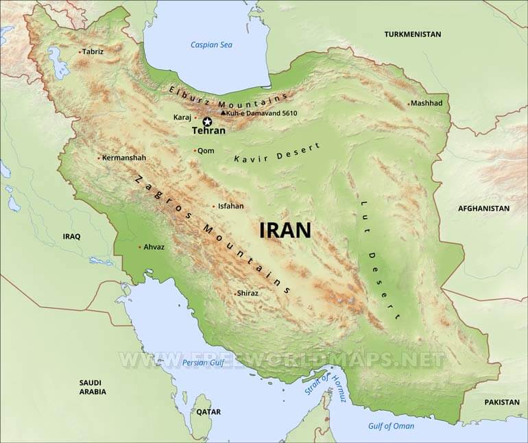
Iran Physical Map
Physical map of Iran, equirectangular projection
Click on above map to view higher resolution image
Iran geography information
Iran's landscape is dominated by rugged mountain ranges that separate various basins or plateaus from one another. The populous western part is the most mountainous, with ranges such as the Zagros and Alborz Mountains, the latter of which also contains Iran's highest point, the Damavand at 5,671 m (18,606 ft). The eastern half consists mostly of uninhabited desert basins with the occasional salt lake.
The only large plains are found along the coast of the Caspian Sea and at the northern end of the Persian Gulf, where Iran borders on the mouth of the Arvand river (Shatt al-Arab). Smaller, discontinuous plains are found along the remaining coast of the Persian Gulf, the Strait of Hormuz and the Sea of Oman. The Iranian climate is mostly arid or semiarid, though subtropical along the Caspian coast. Iran is considered to be one of the fifteen states that comprise the so-called "Cradle of Humanity".
Other maps of Iran
Customized Iran maps
Could not find what you're looking for? Need a special Iran map? We can create the map for you!Crop a region, add/remove features, change shape, different projections, adjust colors, even add your locations!


