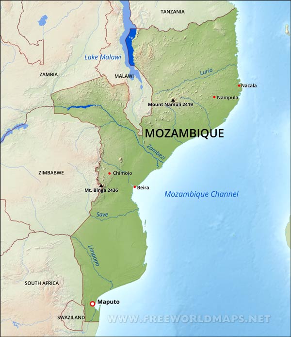
Mozambique Physical Map
Physical map of Mozambique, equirectangular projection
Click on above map to view higher resolution image
Mozambique physical features
The Republic of Mozambique lies in Southeast Africa, on the cost of the Mozambique Channel of the Indian Ocean.
Mozambique has a long stretch of coastal lowlands, with higher terrain inland and some mountains. Major rivers are the Zambezi and the Limpopo.The capital is Maputo, which is also a major port.
Other important cities are Beira, Quelimane, Nampula, Pemba, Tete and Nacala.
Highest peak is the Mount Binga reaching 2436 meters above sea level.

Location map of Mozambique

Other maps of Mozambique
Customized Mozambique maps
Could not find what you're looking for? Need a special Mozambique map? We can create the map for you!Crop a region, add/remove features, change shape, different projections, adjust colors, even add your locations!


