Libya Political Map

Libya Political Map

Political map of Libya, showing the administrative divisions of the country

Click on above map to view higher resolution image

Libya is a country in northern Africa, occupying the region between Egypt and Algeria. The country is divided into 22 1st level administrative divisions since 2007.
Nuqat al Khams
Zawiya
Jafara
Tripoli
Murqub
Misrata
Sirte
Benghazi
Marj
Jabal al Akhdar
Derna
Butnan
Nalut
Jabal al Gharbi
Wadi al Shatii
Jufra
Al Wahat
Ghat
Wadi al Hayaa
Sabha
Murzuq
Kufra
Due to the rapid development in the oil sector, the country has emerged from one of the poorest countries of the world, to one of the richest countries of Africa nowadays.

Other maps of Libya

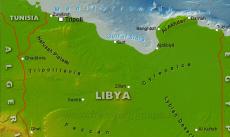
Libya physical map
Libya physical map
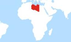
Libya location map
Where is Libya located? Map showing the location of Libya on the globe.

Customized Libya maps

Could not find what you're looking for? Need a special Libya map? We can create the map for you!
Crop a region, add/remove features, change shape, different projections, adjust colors, even add your locations!
Custom map services
World map illustrator
US map illustrator SVG