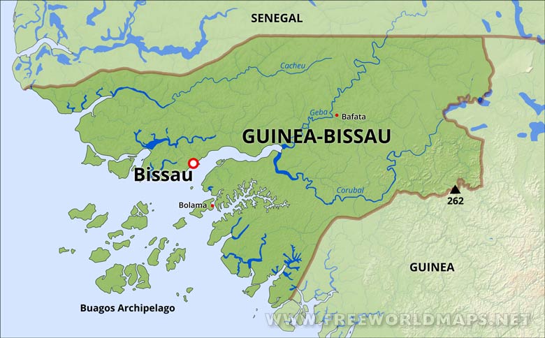
Guinea-Bissau lies at a low altitude; its highest point is 984 feet (300 m). The interior is savanna, and the coastline is swampy plain. Its monsoon-like rainy season alternates with periods of hot, dry harmattan winds blowing from the Sahara. The Bijagos Archipelago extends out to sea.
The capital city is Bissau.
Guinea Bissau Physical Map
Physical map of Guinea Bissau, equirectangular projection
Click on above map to view higher resolution image
Guinea Bissau physical features
Other maps of Guinea Bissau
Customized Guinea Bissau maps
Could not find what you're looking for? Need a special Guinea Bissau map? We can create the map for you!Crop a region, add/remove features, change shape, different projections, adjust colors, even add your locations!


