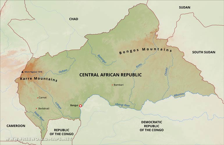
The Central African Republic is a landlocked country located in the central part of the African continent.
The country is dominated by flat Savanna.
In the northeast lie the Bongos Mountains Hills, and there are also scattered hills in southwest part of the country.
To the northwest is the Karre Mountains, a granite plateau.
Much of the southern border is formed by tributaries of the Congo River.
The eastern border lies along the edge of the Nile river watershed.
Important rivers are Ubangi, Mambéré, Ouara, Kotto and Shari.
Mont Ngaoui is the country's highest point at 1410 meters above sea level.
The capital city is Bangui. Other important cities are Mbaiki, Bangassou, Baboua, Sibut and Birua.
Central Africa Physical Map
Physical map of Central Africa, equirectangular projection
Click on above map to view higher resolution image
Central Africa physical features
Other maps of Central Africa
Customized Central Africa maps
Could not find what you're looking for? Need a special Central Africa map? We can create the map for you!Crop a region, add/remove features, change shape, different projections, adjust colors, even add your locations!


