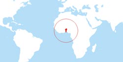
The Republic of
Benin (known as
Dahomey until 1975) lies in Western Africa, between the Gulf of Guinea and the Niger river.
The terrain consists of coastal plain, flat to undulating plain, some hills and low mountains.
Major rivers are the Couffo, the Mono, the Niger and the Oueme.Stretched between the
Niger River in the north and the
Bight of Benin in the south,
Benin's elevation is about the same for the entire country.
Most of the population lives in the southern
coastal plains,
where Benin's largest cities are also located.
The north of the country consists mostly of
savanna and semi-arid highlands.
The largest city and commercial capital is
Cotonou.
Highest point is
Mont Sokbaro rising 658 meters above sea level.
Location map of Benin


