Angola is located in the southern part of the African continent.
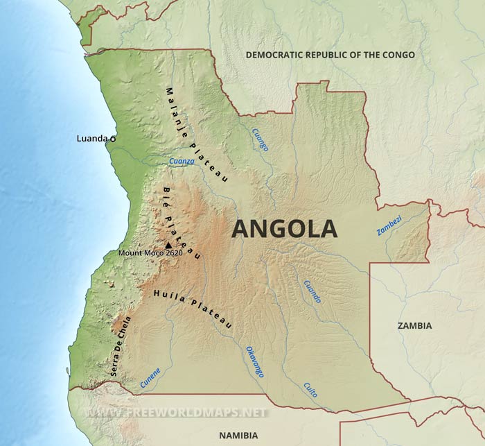
Angola has three principal natural regions: the coastal lowland, characterized by low plains and terraces; hills and mountains, rising inland from the coast into a great escarpment; and an area of high plains, called the high plateau (planalto), which extends eastward from the escarpment.
Principal rivers are the Cuanza and the Cunene.Morro de Moco is the country's highest point at 2620 meters above sea level.
The capital city is Luanda. Other important cities are Benguela, Huambo, Lobito, and Namibe
Angola Physical Map
Physical map of Angola, equirectangular projection
Click on above map to view higher resolution image
Angola physical features
Other maps of Angola
Customized Angola maps
Could not find what you're looking for? Need a special Angola map? We can create the map for you!Crop a region, add/remove features, change shape, different projections, adjust colors, even add your locations!


