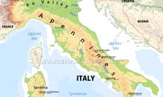
Liguria is a region in the Western part of Italy.
Genoa (Genova) is the capital of the region, which is divided into the provinces of Genoa, Imperia, La Spezia and Savona (named for their principal cities).
Liguria lies on the coast of the Gulf of Genoa and posesses a number of various landscapes. The zone of Appennines meets the ranges of the Alps here.
Cities: Chiavari, Genoa, Imperia, La Spezia, Rapallo, San Remo, Savona
Peaks (elevation in meters): Monte Grammondo 1379 , Monte Maggiorasca 1800, Monte Beigua 1287, Monte Gottero 1639, Monte Oramara 1522, Monte Delle Figne 1172, Monte Carmo 1389
Mountains, regions: Maritime Alps, Ligurian Apennines
Rivers, bodies of water: Ligurian Sea, Gulf of Genoa
Physical map of Liguria
Physical map of Liguria (Italy)
Click on above map to view higher resolution image
About Liguria
Related maps
Customized Liguria maps
Could not find what you're looking for? Need a customized Liguria map? We can create the map for you!Crop a region, add/remove features, change shape, different projections, adjust colors, even add your locations!


