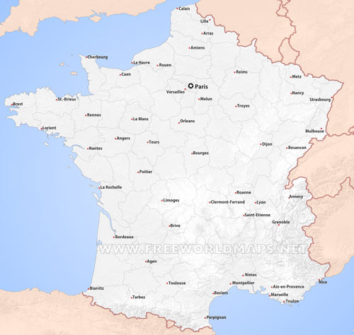
France is divided into 18 regions, out of which 13 are on continental France.
The 13 continental regions are, as shown on the map above:
Auvergne - Rhône-Alpes
Brittany (Bretagne)
Bourgogne - Franche-Comté
Corse (Corsica)
Centre - Val de Loire
Grand Est
Hauts de France
Île-de-France
New Aquitaine
Normandy
Occitanie
Pays-de-la-Loire
Provence-Alpes-Côte d'Azur
Auvergne - Rhône-Alpes
Brittany (Bretagne)
Bourgogne - Franche-Comté
Corse (Corsica)
Centre - Val de Loire
Grand Est
Hauts de France
Île-de-France
New Aquitaine
Normandy
Occitanie
Pays-de-la-Loire
Provence-Alpes-Côte d'Azur
List of the largest and most important cities of France, as for the refence of the above map:
Paris
Marseille
Lyon
Toulouse
Nice
Nantes
Strasbourg
Montpelier
Bordeaux
Lille
Rennes
Le Havre
Reims
Saint-Etienne
Toulon
Grenoble
Dijon
Brest
Clermont-Ferrand
Amiens
Limoges
Tours
Metz
Besançon
Caen
Orléans
Mulhouse
Perpignan
Nancy
Calais
La Rochelle
Saint-Nazaire
Paris
Marseille
Lyon
Toulouse
Nice
Nantes
Strasbourg
Montpelier
Bordeaux
Lille
Rennes
Le Havre
Reims
Saint-Etienne
Toulon
Grenoble
Dijon
Brest
Clermont-Ferrand
Amiens
Limoges
Tours
Metz
Besançon
Caen
Orléans
Mulhouse
Perpignan
Nancy
Calais
La Rochelle
Saint-Nazaire


