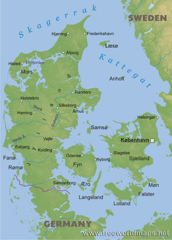
The landscape of Denmark is defined by low lying terrain, a major peninsula, Jutland, with several adjoining bigger and smaller islands. The largest island is Sjælland or Zealand, which is also the home island of capital Copenhagen, being connected by brides to the second largest Danish island of Fyn, and Sweden on the other side by the Øresund bridge built on the Øresund strait. The North Jutlandic Island on the northern tip of the Jutland peninsula is sometimes referred to as being part of the peninsula, however it is cut off from the mainland by the Limfjord making it a real island.
The country is mostly flat, without any significant elevation, the average altitude is solely around 30 meters (100 feet), making it one of the flattest countries of Europe. The coastline has a healthy length of approximately 8700 kilometers which implies a rather erratic coastline, when comparing to the actual size of the country's territory, which cannot be defined exactly, as it changes continuously due to erosion by the ocean and artificial structures.
There a handful of rivers that collect excess water in the country, the longest one is Gudenå, flowing to the east/northeast from the central areas of the main peninsula.


