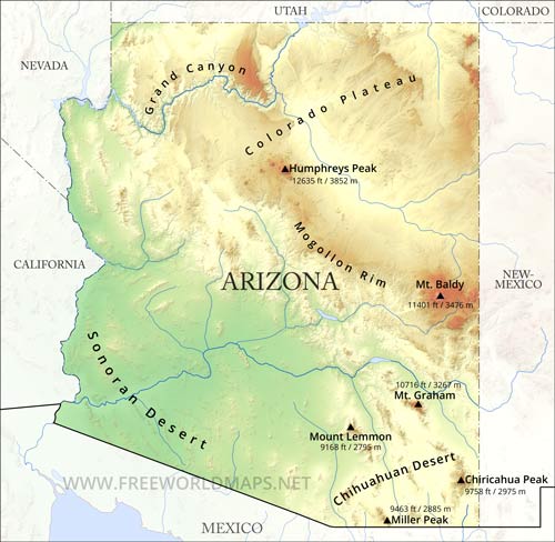
Arizona is best known for its desert landscape.
More than half of the state features mountains and plateaus and contains the largest stand of Ponderosa pine in the United States. The Mogollon Rim, a 600 m escarpment, cuts across the central section of the state and marks the southwestern edge of the Colorado Plateau.
The Grand Canyon is a colorful, steep-sided gorge, carved by the Colorado River, in northern Arizona. The canyon is one of the seven natural wonders of the world.
The capital and largest city of Arizona is Phoenix. The highest point is Humphreys Peak at 3851 m.
Physical map of Arizona
Physical map of Arizona, mountains, lakes, rivers and other features of Arizona
Click on above map to view higher resolution image
Physical features of Arizona
Other maps of Arizona
Check our other maps of the state of Arizona
Customized Arizona maps
Could not find what you're looking for? Need a customized Arizona map? We can create the map for you!Crop a region, add/remove features, change shape, different projections, adjust colors, even add your locations!


