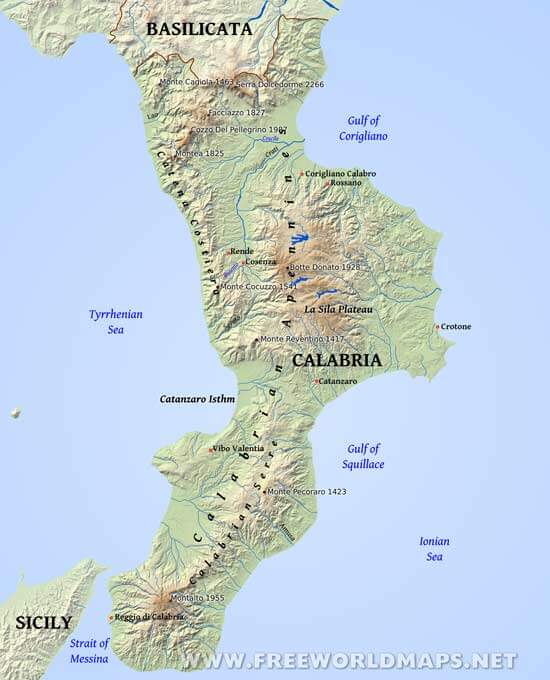
Calabria is bordered by the region of Basilicata on the north, the Ionian Sea on the East, and the Tyrrhenian Sea on the West. Sicily lies on the opposing shores of the Strait of Messina.
The capital is Catanzaro, close to the coast of the Gulf of Squillace. Other cities in the regions include Vibo Valentia, Crotone, Cosenza and Reggio di Calabria. Monte Pollino is the highest peak, which reaches 2245 meters above sea level at the northern part of the region.
Cities: Catanzaro, Corigliano Calabro, Cosenza, Crotone, Reggio di Calabria, Rende, Rossano, Vibo Valentia
Peaks (elevation in meters): Serra Dolcedorme 2266, Montalto 1955, Botte Donato 1928, Cozzo Del Pellegrino 1987, Monte Cocuzzo 1541, Montea 1825, Monte Cagiola 1463, Monte Pecoraro 1423, Monte Reventino 1417, Facciazzo 1827
Rivers: Crati, Savuto, Busento, Coscile, Lao, Amusa
Mountains, regions: Calabrian Apennines, Calabrian Serre, Catanzaro Isthm, La Sila Plateau, Catena Costiera
Bodies of water: Gulf of Corigliano, Ionian Sea, Strait of Messina, Gulf of Squillace, Tyrrhenian Sea


