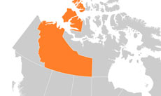
Northwest Territories physical map

Northwest Territories map

Physical map of Northwest Territories, physical features of Northwest Territories

Click on above map to view higher resolution image

Information about the physical features of Northwest Territories

List of the geographical names of Northwest Territories as shown on the map

Main cities:

Aklavik, Hay River, Inuvik, Norman Wells, Tuktoyaktuk, Yellowknife

Major rivers of Northwest Territories:

Mackenzie, Anderson, Horton, Thelon, Liard

Largest lakes of Northwest Territories:

Great Slave Lake, Great Bear Lake, Aylmer Lake, Wholdaia Lake

Mountains, regions:

Mackenzie Mountains, Franklin Mountains

Islands:

Victoria Island, Melville Island, Banks Island, Prince Patrick Island, Mackenzie King Island

Highest peaks (elevation):

Mt. Nirvana 2773, Durham Heights 724

Seas, bays:

Beaufort Sea, Amundsen Gulf, Mackenzie Bay, Melville Sound, Arctic Ocean

Other maps of Northwest Territories

Check our other maps of the state of Northwest Territories

Northwest Territories location map
Location map of Northwest Territories

Customized Northwest Territories maps

Could not find what you're looking for? Need a customized Northwest Territories map? We can create the map for you!
Crop a region, add/remove features, change shape, different projections, adjust colors, even add your locations!
Custom map services
World map illustrator
US map illustrator SVG