Western Europe is the region of Europe that lies on the western part of the continent, between Northern Europe, and Southern Europe.
The largest country of the region is France, which is also the leading tourist destination in the world, offering many type of attractions to the visitors: the sunny beach on the south, Paris, the capital, the castles near the Loire river, spas, the Alps, all take their share in France's tourism.
The Netherlands is mostly famous for its windmills, tulips, cheese and clogs. Belgium's capital is the center of many international organizations (NATO, EU). Luxembourg is notable for the highest GDP per capita value in Europe.
Germany is the world's fourth economical power, and the most important economical power in Europe, though it still shows significant differences between the eastern and the western part of the country, after the 1990 re-union.
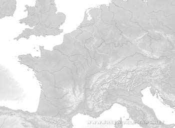
Physical map of Western Europe
Physical map of Western Europe
Click on above map to view higher resolution image
Western Europe physical features
Check our other maps of Western Europe
Customized Western Europe maps
Could not find what you're looking for? Need a customized Western Europe map? We can create the map for you!Crop a region, add/remove features, change shape, different projections, adjust colors, even add your locations!


