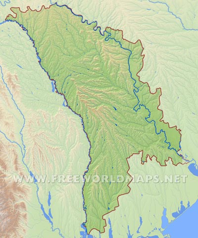
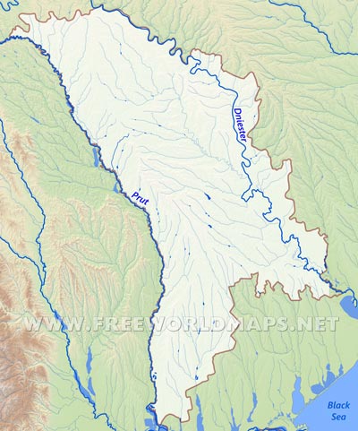
Nested between Romania and Ukraine, the country of Moldova is situated in eastern Europe, bounded by the Prut and Dniester rivers on the western and eastern country borders respectively, not far from the northeastern Black sea shore line.
The geographical landscapes vary throughout the entire country, with hilly regions and plateaus segmented severely by rivers and smaller streams, surrounded by the two governing river valleys. The Dniester Hills on the northeastern regions and the Moldavian Plateau are the highest elevated areas on the Moldova map, Balaneshty (Bălănești Hill) being the highest point of Moldova's terrain at 429 meters located in the Central Moldavian Plateau. The Moldavian Plain accompanying the Prut river in the northwestern region is not a real flatland, rather a lower elevated modest hilly terrain.
The area beyond the Dniester river is called Transnistria, another of those lower lying modest hilly regions, cut into many pieces by the eastern tributaries of the Dniester river. This territory is also a partially recognized state called Transnistria or Transdniestria.
Almost the whole territory of the Moldova map belongs to the watershed of the two major rivers, Prut and Dniester. There are numerous other smaller rivers throughout the country, being the tributaries of these two, but only very few of them reaching a hundred kilometers in length. The Prut river, which flows essentially on the Romanian border, joins the Danube river a few kilometers before emptying into the Black sea. The estuary of the Dniester river, which helps emptying the water into the Black Sea, is located in Ukrainian territory, a few kilometers after leaving Moldavian territory. However, in spite being very close to the shore line of the Black Sea, Moldova has no sea coast.
The climate is temperately continental, snowy cold winters alternating with warm summers. The temperature fluctuation is very high throughout the entire season.


