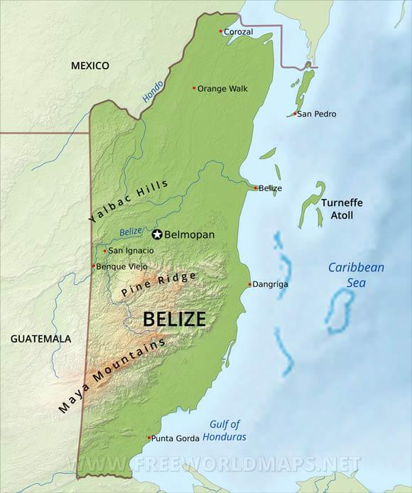
Belize: topographical features divide the Belizean landscape into two main physiographic regions. The most visually striking of these regions is distinguished by the Maya Mountains and the associated basins and plateaus that dominate all but the narrow coastal plain in the southern half of the country. The mountains rise to heights of about 1,100 metres, with the highest point being Victoria Peak at 1120 metres.
The second region comprises the northern lowlands, along with the southern coastal plain. Eighteen major rivers and many perennial streams drain these low-lying areas. The coastline is flat and swampy, with many lagoons, especially in the northern and central parts of the country. Westward from the northern coastal areas, the terrain changes from mangrove swamp to tropical pine savannah and hardwood forest.
Belmopan is the capital city. Other cities include Belize City and Placentia.
The main river is the Belize River.
Belize Physical Map
Physical map of Belize, equirectangular projection
Click on above map to view higher resolution image
Belize physical features
Other maps of Belize
Customized Belize maps
Could not find what you're looking for? Need a special Belize map? We can create the map for you!Crop a region, add/remove features, change shape, different projections, adjust colors, even add your locations!


