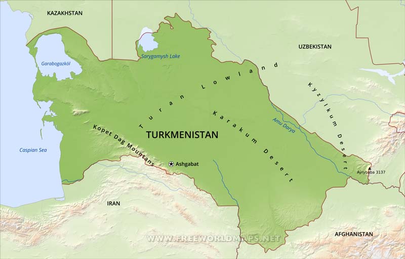
Turkmenistan's average elevation is 100 to 220 meters above sea level, with its highest point being Mount Ayrybaba (3,137 meters) in the Kugitang Range of the Pamir-Alay chain in the far east, and its lowest point in the Transcaspian Depression (100 meters below sea level). The Gora Ardan rises sharply above sea level in western Turkmenistan. Nearly 80 % of the republic lies within the Turan Depression, which slopes from south to north and from east to west.
A dominant feature of the republic's landscape is the Kara Kum Desert, which occupies about 350,000 square kilometers.
Ashgabat is the capital city. Turkmenbashy is a large port on the Caspian Sea. Other important cities are Dasoguz, Mary and Turkmenabat.
Turkmenistan Physical Map
Physical map of Turkmenistan, equirectangular projection
Click on above map to view higher resolution image
Turkmenistan physical features
Other maps of Turkmenistan
Customized Turkmenistan maps
Could not find what you're looking for? Need a special Turkmenistan map? We can create the map for you!Crop a region, add/remove features, change shape, different projections, adjust colors, even add your locations!


