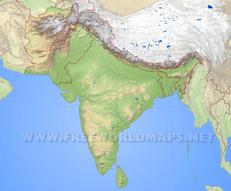
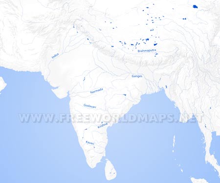
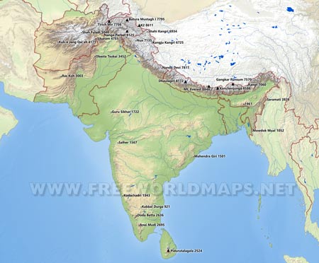
The southern countries of Asia form South Asia. There are eight countries and one island in this region. Bangladesh, Sri Lanka, Bhutan, Maldives, Nepal, Pakistan, Afghanistan and India are the south Asian countries. India takes more than half of the south Asia map with its huge size. While discussing about the area, variations in every part is an amazing fact. Here we are going to focus on its geographical features. Let’s start the discussion with Indian Plate.
Indian Plate is one of the most important tectonic plates in South Asia geography. Most of the countries are based on this plate. Nepal is a victim to the regular movement of the plate. These movements causes earthquake. Basically the Indian Plate is the northern part of Indo-Australian plate. A clash between two tectonic plates has given birth to the Himalayas. One is the Indian plate and another is Eurasian Plate. It happened millions year ago. Indian subcontinent is surrounded by the Indian Ocean and Arab Sea. This is why most of the countries have to face various types of natural calamities regularly. So, the downside part of the South Asia geography is based on Indian plate and it is fenced by Indian, Arab Ocean and Bay of Bengal. Now, the boundary is another important topic of South Asia.
The boundaries are of two kinds. Political and geographical. South Asia geography defines its boundary by the variation of the land. The northern, western and eastern border are covered with water. The water belongs to Indian sea, Arab ocean and Bay of Bengal as we have discussed previously. Once the Indian subcontinent was a single peninsula. A geographical change has brought it closer to the Eurasian tectonic plate. So, the southern side of South Asia map is flatter than the Nepal, Bhutan and Afghanistan. Though the countries are divided by the political border, the height could play an important role for the division too.
The climate of the total south Asia region is as different as people. There are hills, deserts, rivers and forests everywhere. Simply, India has every kind of weather situation. There are four climate sectors in south Asia geography. It’s an interesting matter that some of the regions are tropical and some of the regions are in temperate climate area. Northern India and Pakistan side is a deserted place. This is a proper continental climate. While moving towards Sri Lanka from India, the climate turns into an equatorial climate. Northwest India and Bangladesh are in the tropical zone. It is a greener and livelier zone. Of course the Himalayas has a special climate sector. It is called Alpine climate area.
Most of the area of South Asia map is moist and humid. This is why trees grow a lot in this part of the world. In winter season, a cold monsoon air blows over the area. South Asia geography is a great subject to study for the geographers. It is also in the alarming zone for being affected and flooded by the global warming effect.


