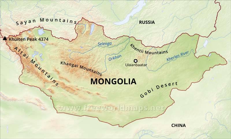
Mongolia Physical Map
Physical map of Mongolia, equirectangular projection
Click on above map to view higher resolution image
Mongolia physical features
Mongolia's terrain is one of mountains and rolling plateaus, with a high degree of relief.
From the Gobi Desert areas of the south, Mongolia rise into a grass-covered and generally treeless plain (steppe), punctuated by three mountain ranges.
Tavan Bogd Uul (sometimes called Nayramadlin Orgil--Mount Friendship) in the Altay Mountains, where the Mongolian, the Soviet, and the Chinese borders meet, is the highest point (4374 meters). The lowest is 560 meters, an otherwise undistinguished spot in the eastern Mongolian plain.
The country has an average elevation of 1,580 meters. The landscape includes one of Asia's largest freshwater lakes Hovsgol Nuur, many salt lakes, marshes, sand dunes, rolling grasslands, alpine forests, and permanent montane glaciers. Northern and western Mongolia are seismically active zones, with frequent earthquakes and many hot springs and extinct volcanoes.
Other maps of Mongolia
Customized Mongolia maps
Could not find what you're looking for? Need a special Mongolia map? We can create the map for you!Crop a region, add/remove features, change shape, different projections, adjust colors, even add your locations!


