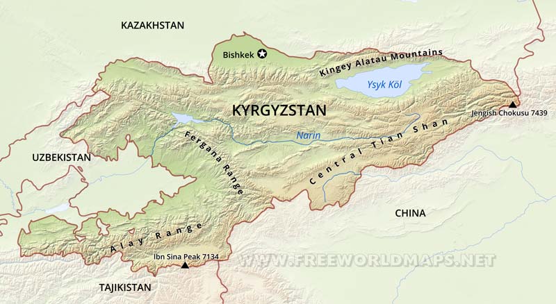
Kyrgyzstan Physical Map
Physical map of Kyrgyzstan, equirectangular projection
Click on above map to view higher resolution image
Kyrgyzstan physical features
Kyrgyzstan is a landlocked nation in Central Asia, west of China.
The terrain of Kyrgyzstan is dominated by the Tian Shan and Pamir mountain systems, which together occupy about 65 % of the national territory. The Alay range portion of the Tian Shan system dominates the southwestern crescent of the country, and, to the east, the main Tian Shan range runs along the boundary between southern Kyrgyzstan and China before extending farther east into China's Xinjiang Uygur Autonomous Region. Kyrgyzstan's average elevation is 2,750 meters, ranging from 7,439 meters at Pik Pobedy (Mount Victory) to 394 meters in the Fergana Valley near Osh. Almost 90 percent of the country lies more than 1,500 meters above sea level.
Bishkek is the capital city. Osh is Kyrgyzstan's second largest city. The Naryn is the longest river. Kyrgyzstan's climate is continental; variations in temperature are influenced by elevation. Summers are hot and dry and winters are cold.
Other maps of Kyrgyzstan
Customized Kyrgyzstan maps
Could not find what you're looking for? Need a special Kyrgyzstan map? We can create the map for you!Crop a region, add/remove features, change shape, different projections, adjust colors, even add your locations!


