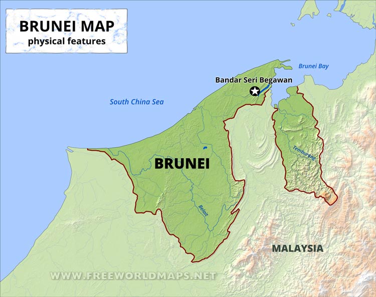
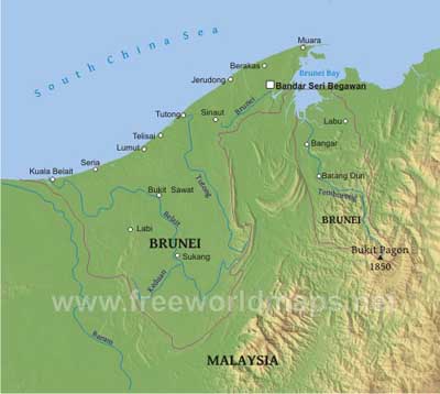
Brunei consists of two unconnected parts. The country is located in Southeastern Asia, bordering the South China Sea and Malaysia.
Most of the country is a flat coastal plain with mountains in the east and hilly lowland in the west. The highest peak is Bukit Pagon at 1850 m.
Major towns are the capital Bandar Seri Begawan, the port town Muara and the oil producing districts of Seria and Kuala Belait.
Brunei Physical Map
Physical map of Brunei, equirectangular projection
Click on above map to view higher resolution image
Brunei physical features
Other maps of Brunei
Customized Brunei maps
Could not find what you're looking for? Need a special Brunei map? We can create the map for you!Crop a region, add/remove features, change shape, different projections, adjust colors, even add your locations!


