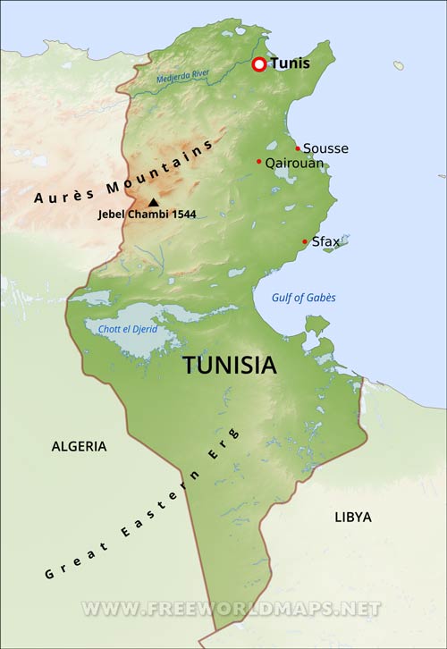
Tunisia Physical Map
Physical map of Tunisia, equirectangular projection
Click on above map to view higher resolution image
Tunisia physical features
Tunisia lies in north Africa, between the Mediterranean Sea and the Sahara Desert.
Coastal plains on the east rise to a north-south escarpment that slopes gently to the west. The Sahara Desert lies in the southernmost part. Tunisia is more mountainous in the north, where the Atlas range continues from Algeria.
The country can be divided into four geographical zones. In the centre is the Tell (or Tunisian Dorsal), the easternmost part of the Atlas mountain range. To the north lies Tunisia's most fertile agricultural region, based around the high plains of the Tell and the country's only permanent river, the Medjerda. To the immediate south the Dorsal drops to a series of salt lakes (or chotts), and below that lays the Saharan region of the Grand Erg Oriental. Finally, the Tunisian coast (or Sahel) has a varied topography and an irregular coastline. It constitutes the heart of Tunisia's economy, with important agricultural activity, industry and ports offering access to external markets. Northern Tunisia enjoys a Mediterranean climate (hot, dry summers and mild, wet winters), while the further south one goes, the hotter and more arid it becomes.
Other maps of Tunisia
Customized Tunisia maps
Could not find what you're looking for? Need a special Tunisia map? We can create the map for you!Crop a region, add/remove features, change shape, different projections, adjust colors, even add your locations!


